
Sitemap
A list of all the posts and pages found on the site. For you robots out there, there is an XML version available for digesting as well.
Pages
Posts
Remote Sensing at a Crossroads: Growth and Critical Reflection
Published:
Remote sensing as a discipline is currently experiencing what appears to be a period of rapid expansion. More programs are being established across universities, more institutes are opening, and the field seems to be flourishing. Yet, behind this appearance of prosperity, there is a need for critical reflection.
Understanding Spatiotemporal Big Data
Published:
Spatiotemporal big data can be understood, to a large extent, as location and trajectory information collected through location-based service (LBS) applications. Because of its fine spatial and temporal resolution and large-scale population coverage, it has significant commercial as well as scientific value.
events
Attended the 1st International Workshop on Remote Sensing Intelligent Mapping (RSIM)
Published:
Presented the poster Integrating Remote Sensing and Street View Imagery for Urban Functional Zone Change Detection at the 1st RSIM Workshop, Hong Kong, 2024.
Attended the 2025 Symposium on Young Scientists in Remote Sensing
Published:
Delivered Mapping Co-Seismic Landslides by Incorporating Tri-Temporal Logical Information in Change Detection Method at the Symposium on Young Scientists in Remote Sensing, Taiyuan, 2025.
Attended the Dragon-6 Symposium
Published:
Presented under the project EO-AI4ResilientCities: Enhancing Urban Resilience with Earth Observation and AI-Powered Insights.
Poster title: Urban Functional Zone Change Detection via Multi-Source Temporal Fusion of Street View and Remote Sensing Imagery.
Attended GeoHB 2025: 2nd International Workshop on Geo-spatial Computing for Understanding Human Behavior
Published:
Participated in the GeoHB 2025 Workshop in Hong Kong and joined the group photo with other attendees.
portfolio
Remote Sensing for Disaster Mitigation — Intelligent Landslide Detection
An intelligent co-seismic landslide mapping algorithm based on tri-temporal remote sensing imagery and logical information fusion, supporting rapid and reliable disaster response. 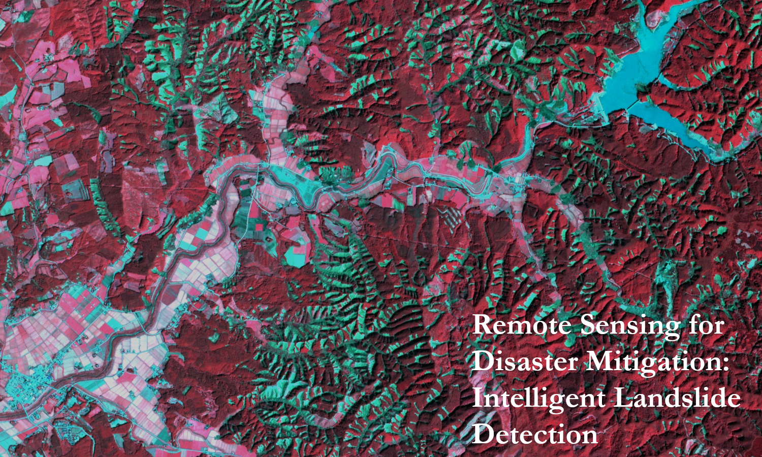
Urban Functional Zone Identification Supported by Geospatial Big Data
This study explores the application of geospatial big data to identify and characterize urban functional zones. It emphasizes the potential of large-scale spatial data and advanced analytical methods to uncover urban spatial patterns and provide valuable support for planning and sustainable development. 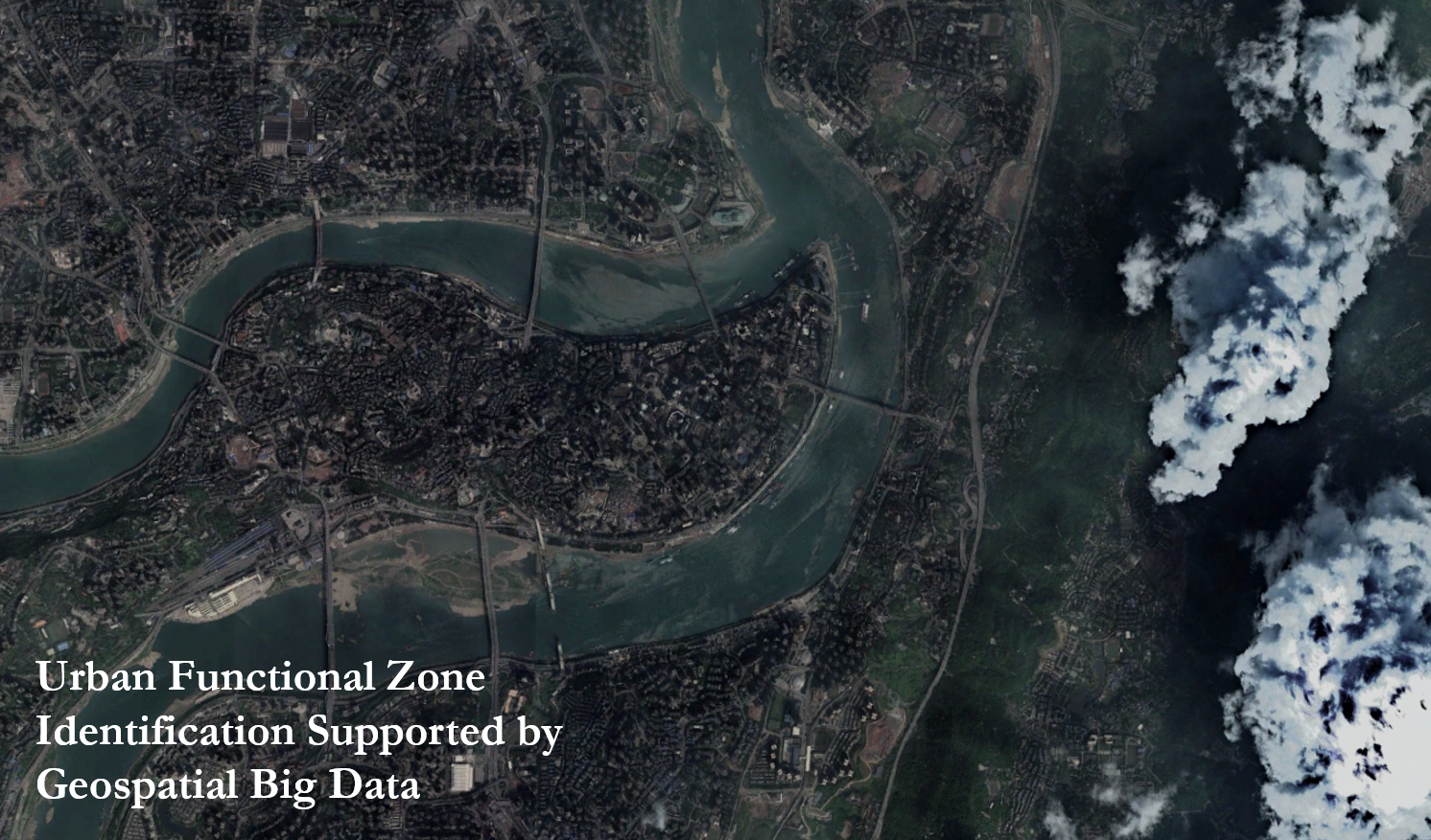
Unveiling Pedestrian Dynamics through Massive Street View Data
This study uses large-scale street view data to examine pedestrian dynamics, providing new perspectives for understanding urban spaces and human activities. 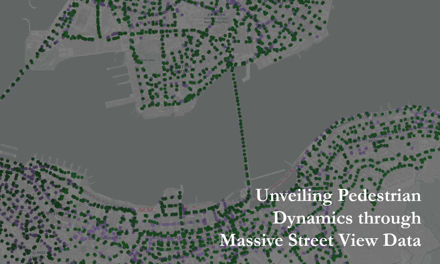
publications
Mapping Co-Seismic Landslides in Vegetated Areas by Incorporating Tri-Temporal Logical Information in Change Detection Method
Published in IEEE Transactions on Geoscience and Remote Sensing, 2024
Introduces a tri-temporal logical change detection method enabling automated mapping of co-seismic landslides in vegetated regions.
Recommended citation: Yang, C., Wang, X., Guo, S., … Du, P. (2024). "Mapping Co-Seismic Landslides in Vegetated Areas by Incorporating Tri-Temporal Logical Information in Change Detection Method." *IEEE Transactions on Geoscience and Remote Sensing*, 62, 4706019.
Download Paper
Influence of urban functional zone change on land surface temperature using multi-source geospatial data: A case study in Nanjing City, China
Published in Sustainable Cities and Society, 2024
Quantifies how shifts in urban functional zones contributed to a 0.71 °C increase in land surface temperature from 2013 to 2022.
Recommended citation: Fang, H., Guo, S., Yang, C., … Du, P. (2024). "Influence of urban functional zone change on land surface temperature using multi-source geospatial data: A case study in Nanjing City, China." *Sustainable Cities and Society*.
Download Paper
Unsupervised Impervious Surface Change Detection Using a Coarse-to-Fine Hierarchical Approach
Published in IEEE Geoscience and Remote Sensing Letters, 2025
Proposes an unsupervised coarse-to-fine hierarchical strategy for detecting changes in impervious surfaces from remote sensing imagery.
Recommended citation: Fang, H., Yang, C., Zhang, P., … Guo, S., & Du, P. (2025). "Unsupervised Impervious Surface Change Detection Using a Coarse-to-Fine Hierarchical Approach." *IEEE Geoscience and Remote Sensing Letters*.
Download Paper
The impact of photovoltaic plants on dryland vegetation phenology revealed by time-series remote sensing images
Published in Agricultural and Forest Meteorology, 2025
Demonstrates that photovoltaic plant deployment advances the start of the growing season in drylands by approximately 13.7 days.
Recommended citation: Xia, Z., Li, Y., Guo, S., … Du, P. (2025). "The impact of photovoltaic plants on dryland vegetation phenology revealed by time-series remote sensing images." *Agricultural and Forest Meteorology*.
Download Paper
Fine-timestamped street view imagery reveals patterns of pedestrian dynamics associated with urban functional characteristics
Published in Cities, 2025
Reconstructs fine-timestamped pedestrian dynamics from Baidu Street View imagery to reveal how urban functional characteristics shape spatiotemporal patterns of pedestrian activity.
Recommended citation: Yang, C., Hong, F., Guo, S., … Du, P. (2025). "Fine-timestamped street view imagery reveals patterns of pedestrian dynamics associated with urban functional characteristics." *Cities*, 169, 106515.
Download Paper
Detecting urban functional zones changes via multi-source temporal fusion of street view and remote sensing imagery
Published in International Journal of Applied Earth Observation and Geoinformation, 2025
Fuses multi-temporal street-view and remote-sensing imagery to detect transitions in urban functional zones, revealing spatial patterns of urban renewal and land-use transformation since 2014.
Recommended citation: Yang, C., Fang, H., Guo, S., Tang, P., Xia, Z., Zhang, X., & Du, P. (2025). "Detecting urban functional zone changes via multi-source temporal fusion of street view and remote sensing imagery." International Journal of Applied Earth Observation and Geoinformation, 144, 104933.
Download Paper
talks
Conference Proceeding talk 3 on Relevant Topic in Your Field
Published:
This is a description of your conference proceedings talk, note the different field in type. You can put anything in this field.
teaching
Teaching experience 1
Undergraduate course, University 1, Department, 2014
This is a description of a teaching experience. You can use markdown like any other post.
Teaching experience 2
Workshop, University 1, Department, 2015
This is a description of a teaching experience. You can use markdown like any other post.